Down Underground
Personal project
For most Londoners the Underground is the quickest and easiest way of getting around town. Millions of people descend into the oldest metro service in the world, travelling from A to B thanks to wonders of engineering and design. Everyone knows they are going underground, but just how deep?
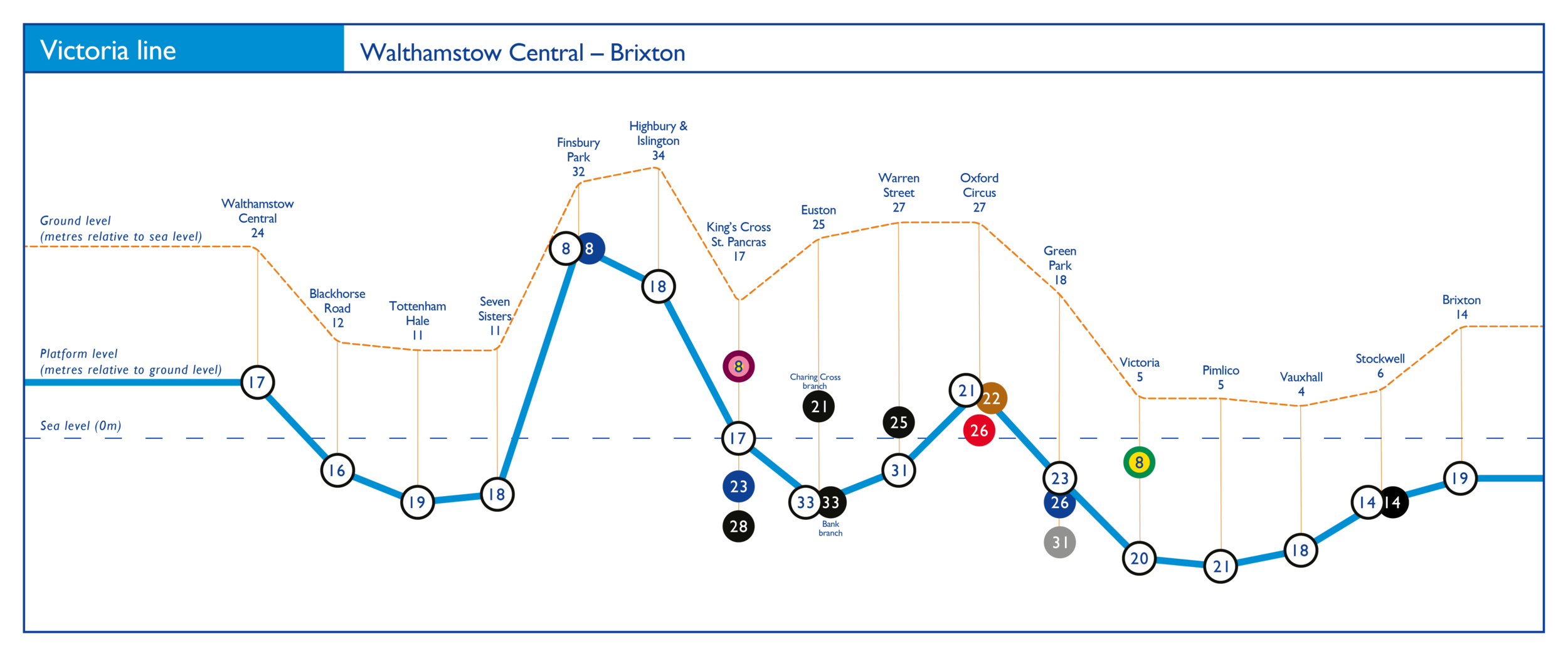
These simple diagrams deliver just that – all Underground services illustrating the height of all stations and platforms, below and above ground.
Featured on the Evening Standard
• •
Featured on the Evening Standard • •
Featured on the Londonist
• •
Featured on the Londonist • •
Featured on the Daily Mail
• •
Featured on the Daily Mail • •
Featured on the London Grill
• •
Featured on the London Grill • •
One day, on my commute to work, I wondered – "How deep underground am I?" Escalators, stairs, lifts, mazes of tunnels… no idea. I searched the internet – a few people have done curiosity maps and played with Beck's design, so surely one of depths must exist. Trawling the internet, seeking to satiate my curiosity, I found nothing. So my curiosity turned into a mission – I would create these. I set on to research and got an excel sheet from TfL.
Taking a page from Beck's book, I couldn't represent distances between stations to scale, as that would have render most diagrams impractical. The only accurate scale would be that of depth. I created the first diagram – the Victoria line, one of the simplest. Once I got on to the Central line I realised my approach had to change – some lines have different branches, and as the diagrams represent a unique path, I couldn't create a single diagram for the whole line.
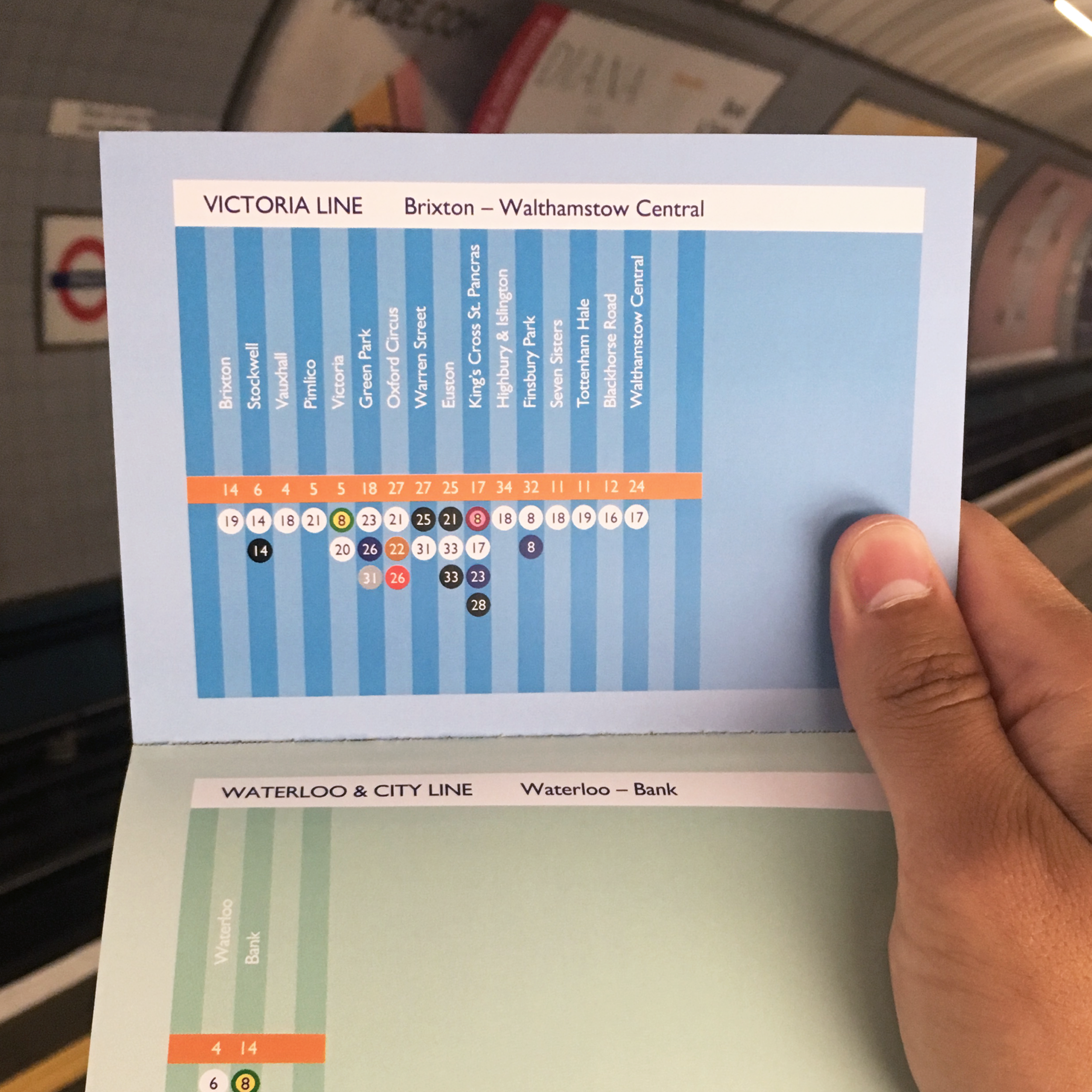
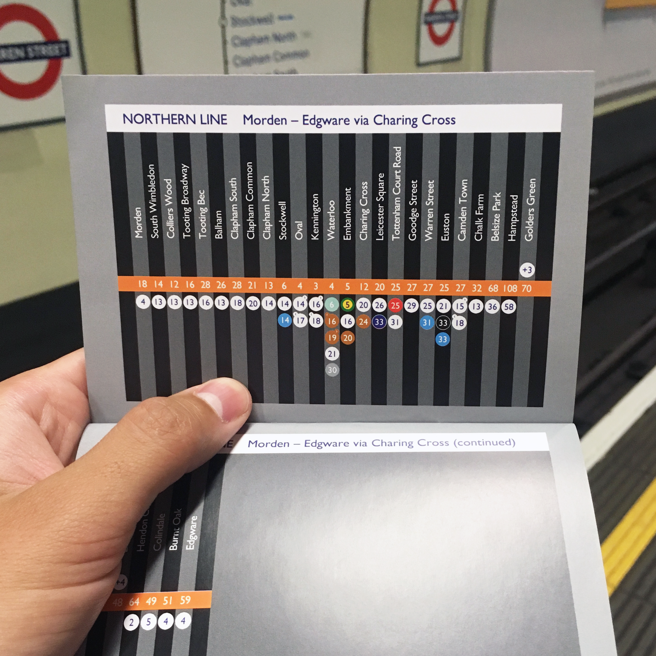
Once the diagrams were complete, I created a pocket booklet to follow underground journeys with ease.
The obvious solution at the time, it seemed, was for me to choose, within each specific Underground line, the minimal number of A-B journeys that would cover all of its stations. Creating the diagrams was time-consuming. So many numbers and calculations, double- and triple-checking. Once the diagrams were completed they didn't seem right – yes, I knew all the depths of the stations, but the way I'd displayed them didn't seem correct.
The answer arrived via the Circle, District and Hammersmith & City lines. These have so many different branches that you need to be certain of which service you get. And this was when the obvious dawned on me. Sure, lines branch out, but trains go from A-B. What the diagrams had to represent was not the lines but the services of these lines. So I checked all the services from all the lines (33 in total) and re-created the diagrams accordingly.
If you would like an A2 poster of these, I print and deliver these in the U.K. for £60. Let me know which one you would like at daniel@dansilva.co.uk. I also sell the booklets for £10 each.


